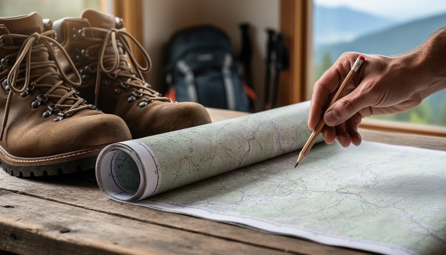
A topography map is a detailed representation of Earth’s surface that uses contour lines, elevation shading, and symbols to show the three-dimensional shape of terrain on a two-dimensional surface. These cartographic tools translate mountains, valleys, ridges, and slopes into readable visual data, making them essential for hikers planning routes, urban planners designing infrastructure, and emergency responders navigating unfamiliar ground. In 2026, you’ll find topography maps available in multiple formats, from traditional paper prints and waterproof versions (ideal for field use) to digital raster and vector files that work with GPS devices and mapping software. Federal topographic maps at scales like 1:50,000 and 1:250,000 remain widely used, with scanned, geo-referenced versions priced around $89.85 CAD, while specialty providers offer custom prints on photographic paper or laminated sheets.
What many people don’t realize is that topography maps have found a home beyond navigation and earth sciences. The intricate line work, organic patterns, and visual rhythm of contour maps have made them surprisingly valuable in creative and therapeutic spaces. Art therapists and wellness practitioners have started incorporating actual topographic imagery into mindfulness exercises, tactile exploration activities, and visual journaling practices. The maps’ non-threatening, abstract-yet-structured appearance makes them accessible tools for people exploring spatial awareness, pattern recognition, and grounding techniques without the pressure of traditional art-making or clinical worksheets.
Understanding Topography Maps: The Basics
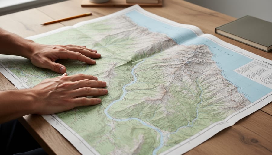
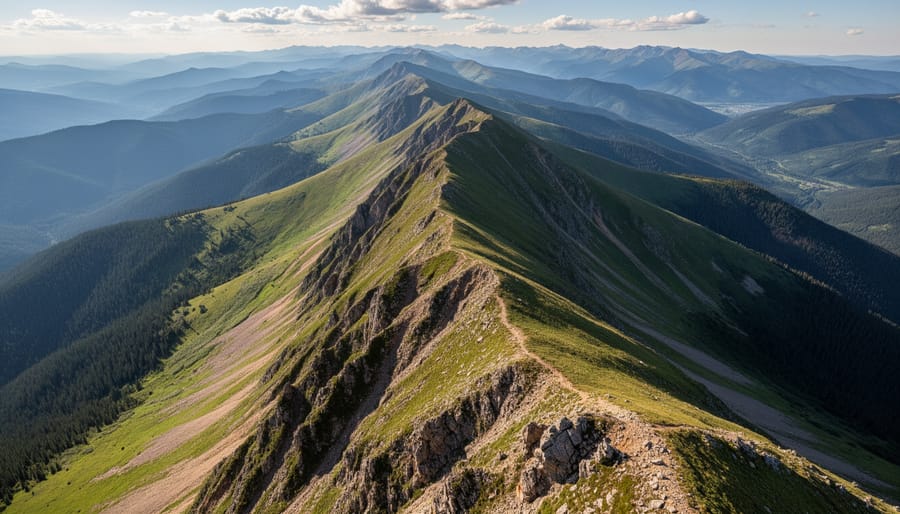
A topography map is a detailed representation of Earth’s surface that translates three-dimensional terrain into a readable, two-dimensional format. These maps show physical features like hills, valleys, mountains, and plains through a system of contour lines, curved lines that connect points of equal elevation. Each contour line represents a specific height above sea level, and the spacing between lines reveals how steep or gradual the land is: lines close together indicate a steep slope, while widely spaced lines suggest gentle terrain.
Scale ratios determine how much real-world distance each map unit represents. A 1:50,000 scale means one centimeter on the map equals 50,000 centimeters (or 500 meters) on the ground, while 1:100,000 covers twice the area in the same space but with less detail. This scale choice affects what you can see and how you use the map, larger scales offer finer detail for hiking or local planning, smaller scales provide broader regional overviews.
Beyond contours and elevation, topographic maps and symbols convey rich information about the landscape. Water features appear as blue lines (streams and rivers) or shapes (lakes and wetlands). Vegetation types are often color-coded, green for forests, white or pale yellow for open land. Human-made structures like roads, buildings, trails, and bridges are marked with standardized symbols, making it easy to locate landmarks and infrastructure.
Topography maps matter because they help us understand physical space in ways satellite images and street maps can’t. Hikers use them to gauge elevation gain and find water sources. Urban planners and engineers rely on topographic data to design roads, manage drainage, and assess land suitability. They’re also essential for environmental monitoring, disaster response, and scientific research. By capturing the shape and character of the land, these maps turn abstract geography into something you can read, interpret, and act on.
Formats and Access: How Topography Maps Are Available Today
Topography maps are available in several formats today, each suited to different needs and contexts. Whether you’re planning a hike, working on a design project, or exploring maps for therapeutic or creative purposes, understanding what each format offers helps you choose the right tool.
Traditional paper prints remain popular for their portability and ease of use in the field. They’re affordable, require no technology, and can be marked up or annotated directly. For more demanding outdoor conditions, laminated and waterproof versions offer durability against rain, mud, and repeated folding, making them practical for extended backcountry use or classroom settings. Photographic paper prints provide higher resolution and color fidelity, which can be particularly appealing when you’re examining fine details or using maps as visual reference material for art projects.
Digital formats have expanded access considerably. Raster formats (like GeoTIFF or JPEG) are essentially image files that can be viewed, printed, or imported into design software. Vector formats (such as SVG or PDF) allow for scaling without quality loss and enable customization of colors, layers, and elements, useful for graphic designers and educators. Scanned and geo-referenced federal topographic maps, typically available at scales like 1:50,000 or 1:250,000, combine the detail of historical survey work with the flexibility of digital files. Digital terrain models take this further, representing elevation data in formats that support 3D visualization and spatial analysis.
Common formats and their typical uses include:
– Paper prints: Field navigation, basic reference, budget-friendly exploration
– Laminated or waterproof prints: Outdoor activities, educational settings, repeated handling
– Photographic paper prints: High-detail viewing, framing, visual art reference
– Raster digital files: Screen viewing, standard printing, integration into mixed media
– Vector digital files: Scalable design work, customization, layered projects
– Geo-referenced scans: GIS applications, research, overlay with other spatial data
– Digital terrain models: 3D visualization, terrain analysis, advanced mapping projects
Formats and pricing vary by provider and region, so it’s worth exploring options that fit your specific needs and budget. Many government agencies offer free digital downloads of topographic maps for their jurisdictions, while commercial providers may offer enhanced versions, specialized scales, or print-on-demand services. The key is matching the format to how you intend to use the map, whether that’s navigating trails, creating art, facilitating a therapy session, or simply satisfying curiosity about the landscape around you.
Topography Maps in Visual Arts and Design
Artists and designers have long been drawn to the distinctive visual language of topography maps. The repeating curves of contour lines create natural rhythm and pattern, while the interplay of elevation markers, symbols, and color gradients transforms functional geographic data into striking compositions. These maps offer a ready-made abstraction, layers of line and form that capture the complexity of terrain without needing to literally depict every rock or tree.
In mixed media art, topographic maps appear as collage elements, background textures, and structural frameworks. Some artists cut and layer maps to build three-dimensional relief sculptures, echoing the elevation they represent. Others isolate portions of contour patterns, enlarging and recontextualizing them until the original geographic reference fades and pure visual rhythm remains. The formal qualities, concentric loops, tight spacing where slopes steepen, wide spacing across gentle plains, translate beautifully to canvas, paper, and digital screens.
Textile designers have embraced topographic imagery for fabric prints, quilts, and woven pieces. The linear elegance of elevation lines works well in monochrome or can be enhanced with color gradients that mirror the blues, greens, and browns of traditional map palettes. These designs carry a subtle geographic reference while functioning as abstract pattern, appealing to anyone who appreciates the intersection of data visualization and aesthetics.
Installation artists incorporate large-scale topographic projections, maps mounted on walls, or suspended layers of transparent material traced with contour lines. These works invite viewers to move through space and experience the map as environment rather than flat reference. The scale shift, from a foldable paper guide to an immersive room, transforms the map into an experiential object.
In graphic design, topographic elements add texture and depth to posters, branding, and digital interfaces. Designers borrow the visual vocabulary of maps, grids, legend symbols, coordinate systems, to structure layouts or suggest journeys and exploration. The connection between graphic design for healing extends to how these map-inspired visuals can evoke calm, order, and a sense of place within therapeutic contexts.
Why do these geographic documents resonate as art objects? Topography maps balance complexity with clarity. They distill vast, irregular landscapes into comprehensible patterns, offering both information and beauty. That duality, utility and aesthetics, makes them endlessly compelling for creative exploration.
Therapeutic and Mental Wellness Applications
Creating Personal ‘Maps’ as Metaphor
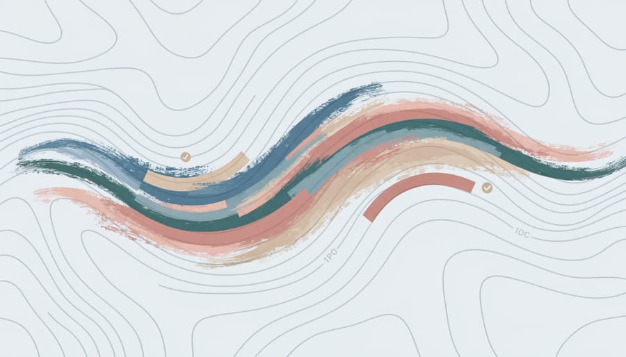
Topography maps offer a powerful visual language for metaphorical art therapy exercises. The same principles that cartographers use to represent physical terrain, elevation, contour lines, boundaries, landmarks, can help clients map their emotional landscapes and personal journeys in concrete, tangible ways. In art therapy mindfulness practices, actual topographic map elements become tools for self-exploration rather than navigation.
One practical activity involves creating a personal map using topographic conventions: clients mark emotional highs and lows as elevation changes, draw contour lines around comfort zones or boundaries, and place symbols for significant life events as landmarks. This exercise grounds abstract feelings in the structured visual system of real maps. Another approach asks participants to trace existing contour patterns from actual topographic maps while reflecting on their own emotional terrain, using the repetitive, meditative quality of following lines as both creative expression and calming focus.
These activities work well in individual sessions and group settings, and they translate effectively to online art therapy formats where clients can work with printed maps or digital versions. The beauty of topography-based metaphor work is its accessibility, you don’t need artistic skill or previous map-reading experience. The geographic structure provides a framework that makes emotional exploration feel safer and more organized. Combined with other de-stress techniques mapping exercises offer a unique blend of creativity, reflection, and grounding in something real and external.
Practical Considerations: Working with Topography Maps
Getting started with topography maps is straightforward once you know what to look for. Whether you’re planning a creative project, exploring therapeutic exercises, or simply curious about these geographic tools, a few practical pointers will help you choose and use maps that suit your purpose.
Scale matters most. Maps come in different ratios, 1:50,000 means one unit on the map equals 50,000 units in real life, while 1:100,000 covers a larger area with less detail. For art projects or therapeutic work where you want to trace intricate contour patterns, smaller-scale maps (like 1:20,000) show finer terrain features. For broader landscape views or larger installations, 1:100,000 or 1:250,000 works well. Think about what region interests you, your hometown, a place with emotional significance, or terrain that appeals visually.
Reading contour lines takes practice but the basics are simple. Lines close together indicate steep slopes; lines far apart show gentle terrain. Each line represents a specific elevation, and where they form circles, you’re looking at hills or depressions. Most maps include a legend explaining symbols for water features, vegetation, and structures.
Formats and costs vary widely. You’ll find paper prints, laminated or waterproof versions for durability, photographic paper options, and digital files in raster or vector formats. Scanned federal topographic maps offer geo-referenced data, and digital terrain models provide three-dimensional information. Payment methods differ by provider, some accept credit cards, others prefer electronic transfers. Prices range based on format, size, and detail level, so explore what fits your budget and needs without feeling locked into expensive options.
What scale topography map should I use?
For detailed art or therapeutic work, choose smaller scales like 1:20,000 or 1:50,000 that show intricate terrain features. Larger scales like 1:100,000 work better for broad landscape views or when you want to cover a bigger geographic area.
How do I read contour lines?
Contour lines connect points of equal elevation. Lines close together mean steep terrain, while widely spaced lines indicate gentle slopes. Circular patterns show hills or depressions, and every line represents a specific height above sea level.
Can I use digital maps for art projects?
Absolutely, digital formats give you flexibility to resize, print, project, or manipulate topographic imagery. Raster and vector files work well for design software, and you can print them at various sizes depending on your creative vision.
Are topography maps expensive?
Costs vary by format, scale, and provider. You’ll find options across price ranges, from affordable digital downloads to premium printed versions, so you can choose what matches your budget and project needs.
For incorporating maps into wellness practices, start simple. Tracing contour lines can become a meditative exercise, while coloring elevation zones offers a calming focus activity. You might photocopy a section of a map and use it as a journaling backdrop, or create collages combining topographic patterns with personal imagery. The structured, repetitive nature of contour lines makes them particularly suited to grounding exercises, following the curves with your finger or a pen helps anchor attention in the present moment.
Don’t worry about getting the “right” map. The one that draws your eye, represents a place you care about, or simply feels interesting is the right starting point. You’re not training as a cartographer, you’re exploring a visual language that connects physical landscape with personal expression.
Topography maps offer far more than directions and coordinates. Whether you’re drawn to the crisp geometry of contour lines, the challenge of reading elevation and terrain, or the creative potential of transforming geographic data into art, these tools invite exploration on multiple levels. They’re rooted in practical cartography, helping us navigate physical landscapes, plan routes, and understand the earth beneath our feet, but they also speak to something deeper: our need to make sense of space, both external and internal.
You don’t need specialized knowledge or expensive equipment to engage with topography maps. Formats range from affordable paper prints to digital files, making them accessible for students, artists, therapists, and curious minds alike. Working with these maps can ground you in the tangible details of real terrain while opening up metaphorical territory, personal journeys, emotional contours, creative pathways.
As you explore topography maps, consider them bridges: connecting geography to art, navigation to introspection, technical skill to imaginative expression. They belong in classrooms and studios, therapy rooms and hiking packs, reminding us that understanding where we are, on the map and in ourselves, is always within reach.
